

Windows · Others
Melhores alternativas Linux ao ESRI ArcGIS
ArcGIS is Esri's commercial GIS suite for professional mapping and spatial analysis.
Atualizado em
Resposta rápida
A melhor alternativa Linux ao ESRI ArcGIS é o JOSM. Outras boas opções: Quantum GIS.
2 alternativas Linux ao ESRI ArcGIS
-

JOSM é um editor offline baseado em Java, rico em recursos, para dados do OpenStreetMap.
JOSM is not a general-purpose replacement for ArcGIS; it is a specialized tool for editing OpenStreetMap data. If your work centers on contributing to OSM, JOSM is excellent. However, for professional GIS workflows involving complex spatial analysis, enterprise geodatabases, or large-scale…
Cobertura de recursos25% -
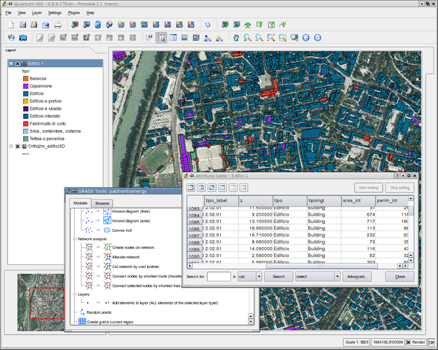
QGIS is a free, open-source Geographic Information System for viewing, editing, and analyzing spatial data on Linux.
QGIS is a strong replacement for ArcGIS if your workflow relies on standard vector/raster analysis, Python automation, or cartographic layout. It handles buffer, overlay, and dissolve operations well and supports common spatial databases. However, it is not a drop-in replacement for enterprise…
Cobertura de recursos75%


O que é o ESRI ArcGIS?
ArcGIS is a comprehensive geographic information system used by governments, utilities, environmental firms, and academia for creating maps, analyzing spatial data, and managing geodatabases. It provides a full stack of desktop, server, and cloud tools that integrate tightly with proprietary data formats and extensions.
The software is sold under a commercial license with per‑user or enterprise pricing, often requiring annual maintenance fees. It runs on Windows and, in some cases, macOS, but there is no official native Linux version.
Because many organizations run Linux servers or prefer open‑source tools, users look for Linux alternatives that can read ArcGIS data, perform similar analyses, and avoid costly licensing.
O que um substituto do ESRI ArcGIS precisa fazer
- Vector and raster data editing
- Spatial analysis (buffer, overlay, network)
- Geodatabase support (File/Personal/Enterprise)
- Cartographic layout and map publishing
- Scripting/automation (Python, ModelBuilder)
- Plugin ecosystem for extensions
- Interoperability with common GIS formats
Dá para usar o ESRI ArcGIS no Linux?
ArcGIS does not have a native Linux client. Some users run the Windows version through Wine or a virtual machine, but functionality is limited and not officially supported. Esri offers ArcGIS Online, a web‑based platform that can be accessed from any browser, including Linux, for basic mapping and analysis.
Qual alternativa escolher?
For users needing a full‑featured desktop GIS, QGIS is the closest match, offering extensive analysis tools and plugin support. JOSM and Merkaartor are lightweight editors focused on OpenStreetMap data, suitable for contributors rather than heavy spatial analysis.
Levando seus arquivos e hábitos do ESRI ArcGIS
ArcGIS can export data to open formats like Shapefile, GeoJSON, and GeoPackage, which QGIS imports without issue. Geodatabase files can be read by QGIS using the GDAL/OGR drivers, though some enterprise geodatabase features may require additional configuration.
Comparação lado a lado
| Aplicativo | Licença | Flatpak | Versão mais recente | Cobertura de recursos | Avaliação |
|---|---|---|---|---|---|
| JOSM | GPL-2.0+ | ✓ | 19613 | 25% | — |
| Quantum GIS | GPL-2.0-or-later | — | — | 75% | — |
ESRI ArcGIS: perguntas frequentes
Can I run ArcGIS Desktop on Linux?
Not natively; you would need Wine, a VM, or use ArcGIS Online for limited functionality.
Is QGIS able to open ArcGIS .mxd files?
QGIS can import .mxd files via the 'Project → Import/Export → Import ArcGIS Project' tool, but complex symbology may not translate perfectly.
Do JOSM and Merkaartor support raster analysis?
No, they are primarily OSM editors and lack raster or advanced spatial analysis capabilities.
What about scripting in Linux alternatives?
QGIS supports Python (PyQGIS) and has a rich set of plugins for automation, comparable to ArcGIS's Python toolbox.
Qual a importância do ESRI ArcGIS para você?
Conhece uma alternativa melhor? Sugerir uma alternativa